Trusted News Discovery Since 2008
{{/content}}
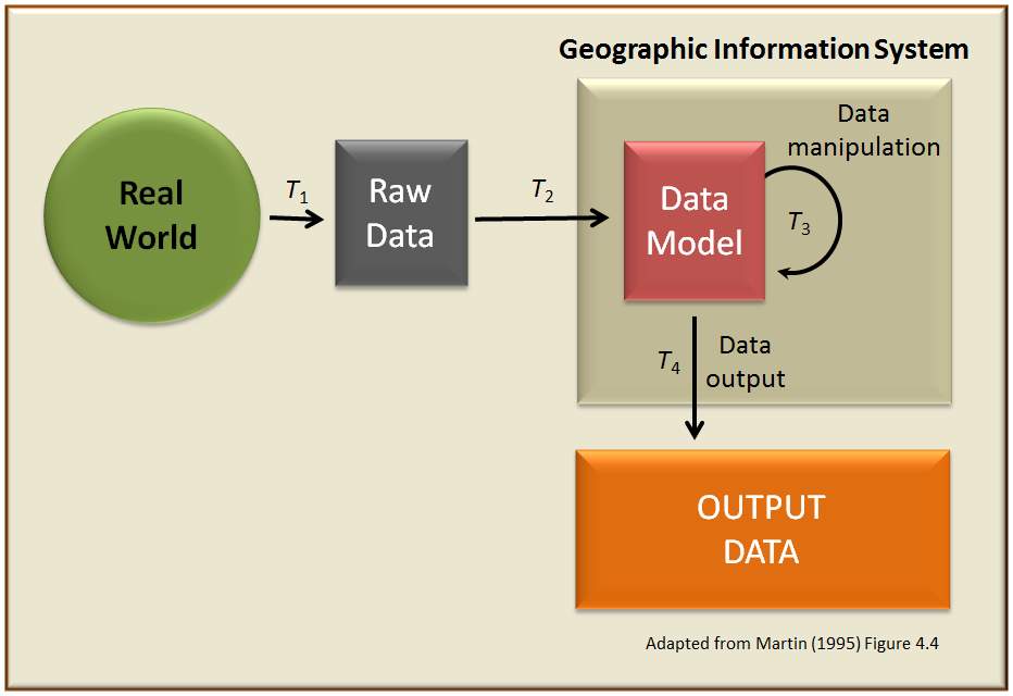
Geographic information system
System to capture, manage, and present geographic dataGeographic information system News and Videos LIVE
ℹ️ This is a LIVE page which updates automatically as we're monitoring our hand-curated selection of verified and trustworthy media outlets